1. Geographical location and basic overview
(1) Geographical location
Gongga Snow Mountain, also known as Muya Gongga Snow Mountain, is located at the junction of Luding, Kangding, Jiulong and Chengdu Counties in Sichuan. It is the main peak of Daxueshan. With an altitude of 7,556 meters, Gongga Mountain is the highest mountain in Sichuan Province and is known as the ”King of Shushan’. There are many peaks in the mountainous area, with deep ice and snow, and many dangers and obstacles. The difficulty of climbing is higher than that of all 8,000-meter snow-capped mountains in the world. Therefore, it is also a famous mountain favored by mountaineering enthusiasts.
(2) Basic overview
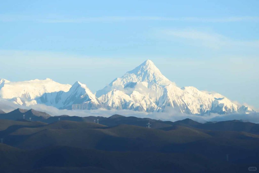
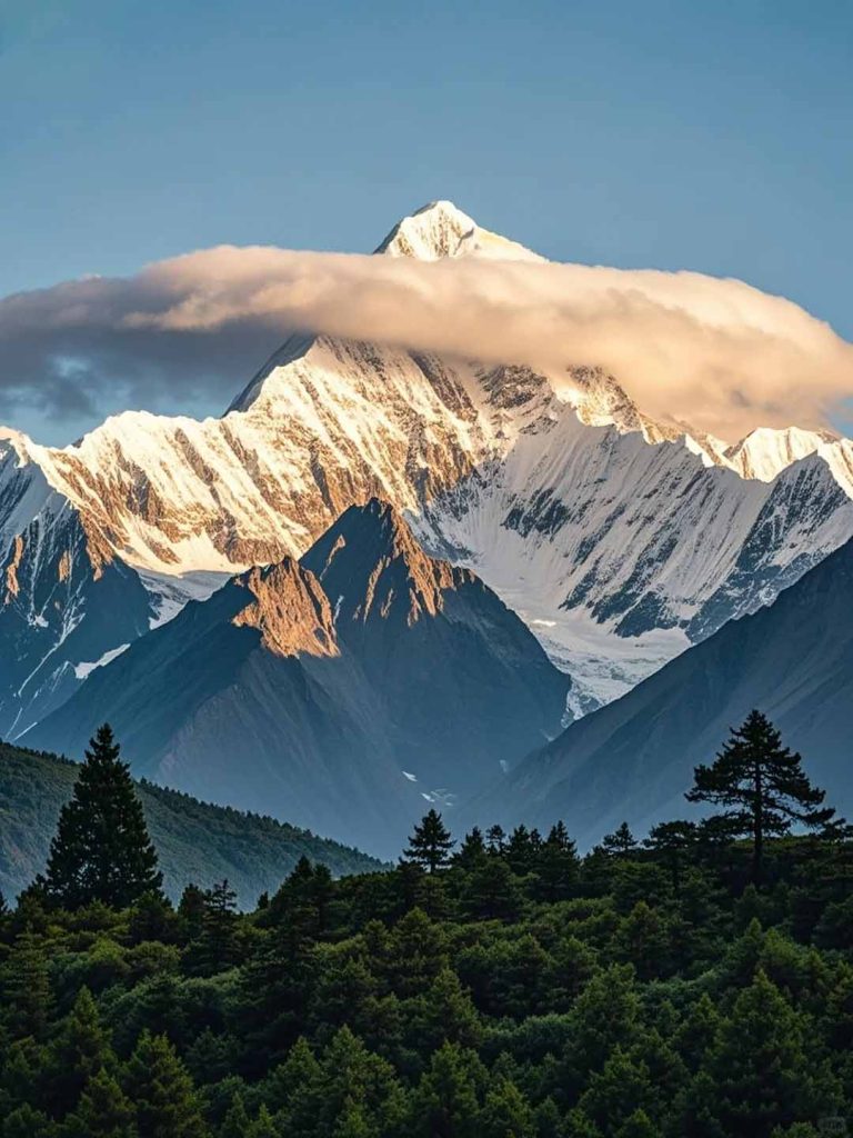
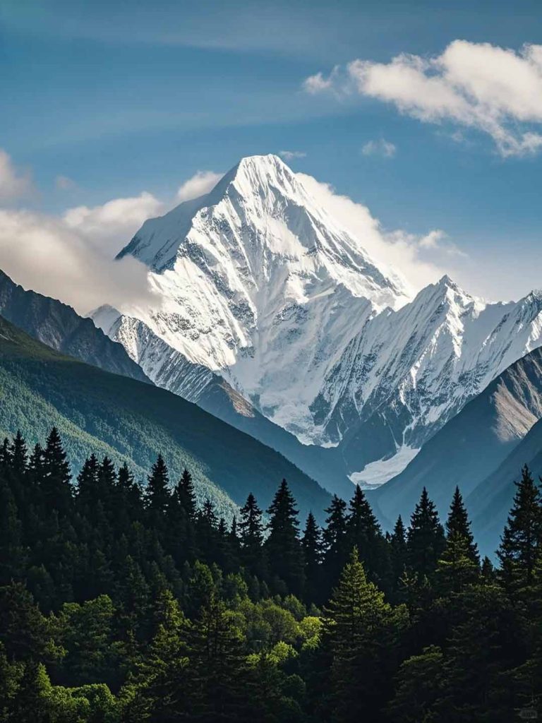
Gongga Mountain has a unique geological landscape. It belongs to the young pleated mountain system, which has been shaped by long geological changes and strong crustal movements. The horns of the mountains are sharp, and the main peak is a typical pyramid giant mountain peak, shining with a metallic luster under the sunlight. Glacial landforms such as U-shaped valleys, ice buckets, and blade ridges are widely distributed. The 14.7-kilometer-long glacier in Hailuogou, pouring down from the steep canyon, is majestic, allowing people to experience the ingenuity of nature up close.
Mount Gongga is an internationally renowned holy place for alpine exploration and mountaineering, but Mount Gongga is also the most difficult large-scale extremely high peak to conquer, and its difficulty in reaching the top is much greater than Mount Everest. According to incomplete statistics, so far, only 25 people have successfully climbed to the top, and the death rate of mountaineering far exceeds that of Everest and Chogori, and is second only to Meili Snow Mountain andYala Snow Mountain.
2. Core attractions
(1) Geological landscape
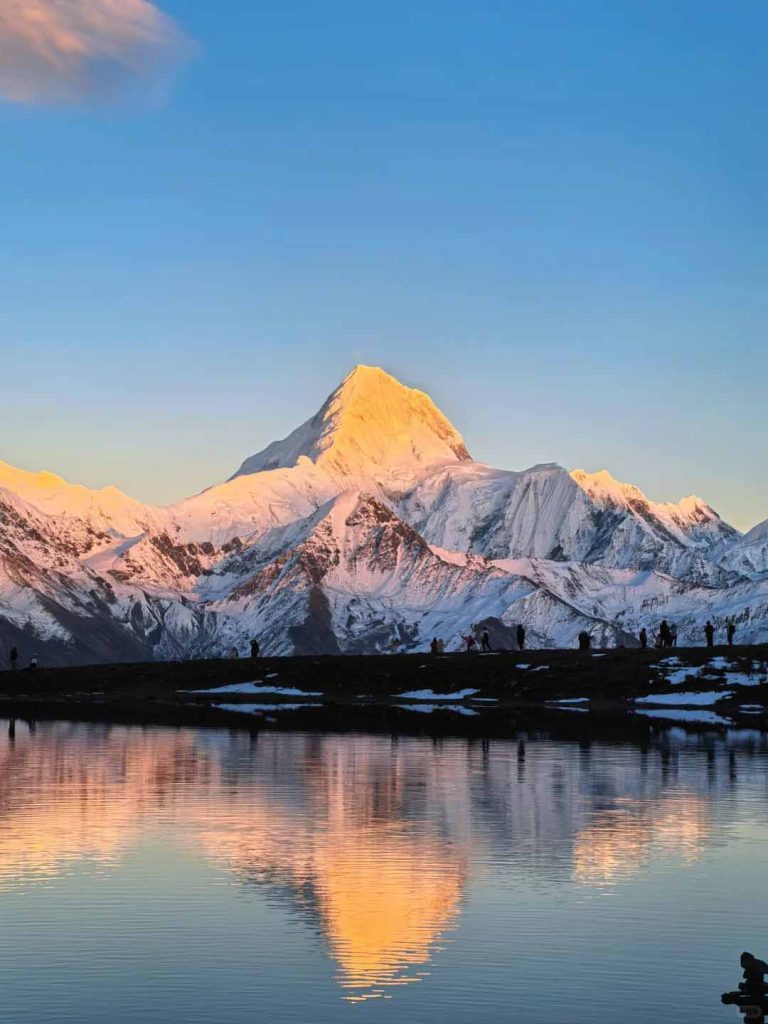
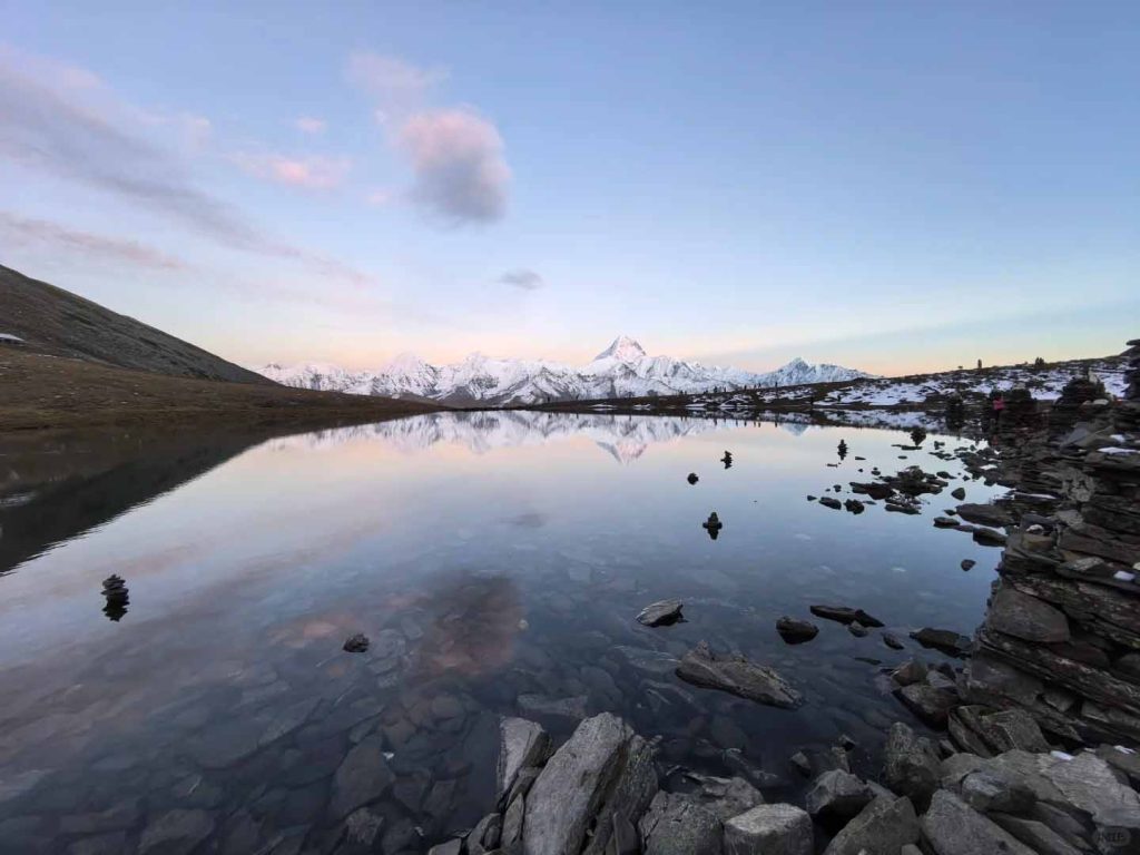
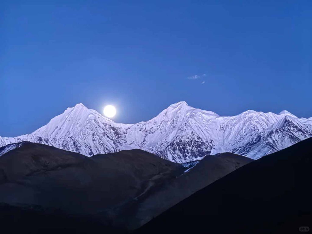
Lengatso:An “observation deck” that many photographers and hiking enthusiasts will not miss. The morning is the best time to take pictures of the reflections of Gongga snow-capped mountains. If you are lucky enough to encounter a windless sunny day, the sun dispels the mist, the sky is clear and cloudless, and the snow-capped peaks are reflected on the water, which is tremendously beautiful.
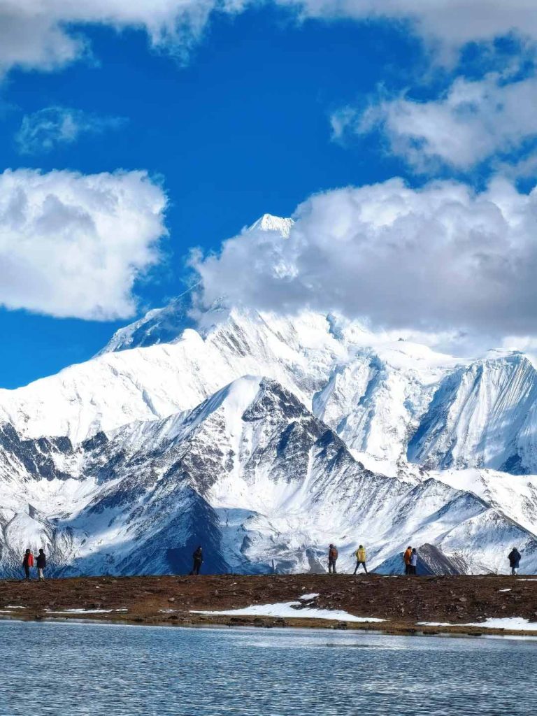
Risuo Sea:The closest sea to Gongga Xueshan at an altitude of 4550m, there are two upper and lower Haizi, both of which can take pictures of the reflection of Gongga Xueshan, but in comparison, the upper Risuo Sea has a better angle.
Quanhuatan:Located in Yulongxi Village, Gonggashan Township (formerly Liuba Township), Kangding City, on the western slope of Gongga Mountain, at an altitude of about 4,000 meters, it belongs to the grassland landscape of the high mountain valley, and Gongga Mountain is to the southeast.
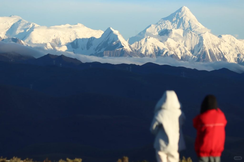
Zimei Pass: It has a straight distance of only 5 kilometers from the main peak of Gongga. It is not only a great place to watch Gongga up close, but also the earliest Gongga position discovered. Here, you can enjoy the panoramic view of Gongga snow-capped mountain, with magnificent and rolling peaks.
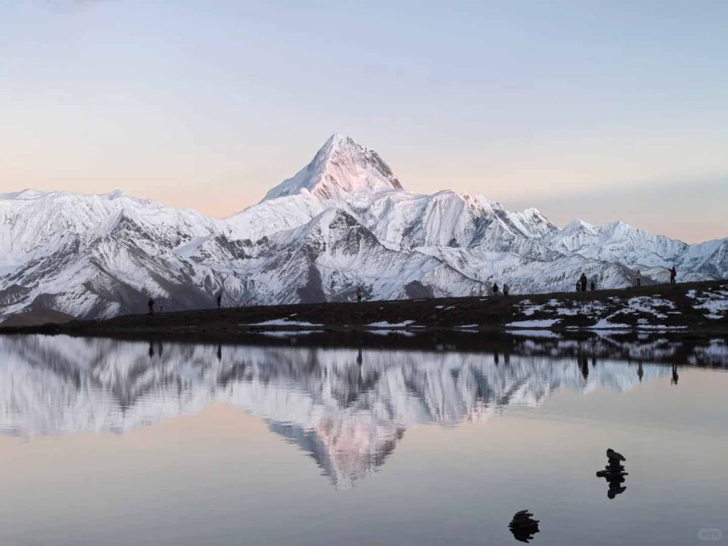
Stintsuo:At an altitude of 4260 meters, you can see Gongga Snow Mountain and Yala Snow Mountain at the same time. The telephoto lens can capture the more steep side of Gongga Mountain. The field of view is very wide. If you are lucky, planes, snow-capped mountains, lakes, and reflections are reflected in each other, which is beautiful.
Kangding Airport:Kangding Airport, the most beautiful plateau airport in China at an altitude of 4290m, is set against the background of Gongga, the king of Shushan, with the snow-capped mountains as a foil. On the rainbow Road to Kangding Airport, Gongga snow-capped mountains and Stintsuo are close at hand, and herds of cattle can be seen taking off through Gongga and flying into the sky when they look up.
Nama Peak:The peak is 5588m above sea level. It is located to the west of the main peak of Gongga. It is currently the most beautiful of the 5000m snow-capped mountains with commercial climbing teams in China.
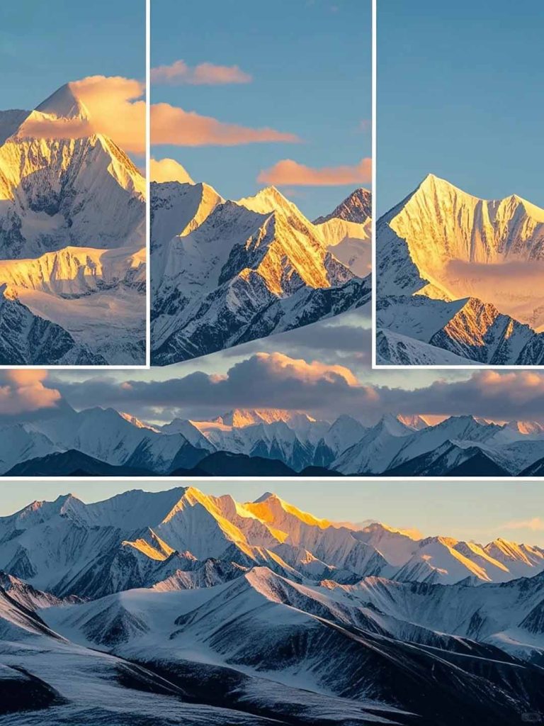
WangGangping:At an altitude of 3000 meters, you can see many peaks and snow-capped mountains with an altitude of more than 5,000 meters. It is the best place to view the golden mountains of Gongga Rizhao from one mountain. It is a camera spot not to be missed by photography enthusiasts.
Old Gongga Temple:Located on the western slope of Gongga Snow Mountain, it is facing the big and small Gomba Glacier. Although the slopes on both sides are obscured when viewing the snow mountain, the flying prayer flags are used as the foreground, and the snow mountain looks more holy.
(2) Humanities
Gongga Mountain contains a deep cultural heritage and is one of the sacred places of Tibetan Buddhism. There are many surrounding temples, such asTagongTemple, which has a history of more than 1,000 years. The temple houses many precious Buddhist cultural relics, carrying the inheritance and development of Tibetan Buddhism. The believers turned their scriptures piously and prayed for blessings, adding a mysterious and solemn atmosphere to this land.
3. Precautions for Touring
(1) Safety protection: responding to geological and weather characteristics
The climate of Gongga Mountain is complex and changeable, with significant vertical differences. The sun is shining and the warmth is like spring under the mountain, the mountainside is misty and the temperature drops sharply, while the top of the mountain accumulates snow all year round and the wind is howling. Tourists may go through four seasons in one day. This unique climate has created a rich ecosystem.
(2) Tour planning: reasonable arrangement of time and route
1. The weather at the top of Gongga Peak is extremely harsh
The weather in Gongga changes all year round, which is basically abnormal, and there are not many days when the weather is clear and sunny. Especially hurricanes with exaggerated wind speeds enveloped the mountains. Once spring ushers in, the heavy fog and blizzard in winter, the plummeting low temperature and snowstorm will stop all mountaineering.
2. The mountains of Gongga are steep, and the development cannot compare with the 8000m peaks.
Gongga is indeed called the lord of tens of thousands of mountains, the king of Shushan. The entire Hengduan Mountain range stretches for more than a thousand kilometers. Only Gongga stepped on Hailuogou to break through the shackles of 7,000 meters. Zhongshan Peak (6886m), the second highest mountain in the Hengduan Mountain system, can only be used as Gongga’s guard peak to protect it.
Gongga is a typical triangular/pyramid-shaped giant snow-capped mountain. The glaciers such as Hailuogou that have developed at the foot of the mountain are very mature, and there are countless cracks and smooth rock walls hidden under the snow attached to the mountainside, which is very challenging for rock climbing. The slope of the ridge is very steep, and the slope of most ridges can reach more than 70 degrees. For many people, 70 degrees may not be a concept. Take the big peaks of Si Girl Mountain for comparison. Yakou Base Camp began to climb, and the slope of the hillside was only 30-40 degrees. The same 7000m-level Mustag Peak (7546m) has a maximum slope of only 35 degrees.
At the end of Gongga Mountain, there are huge ice crevices hidden in the steepness. Without enough experience, strength, and luck, it is undoubtedly very difficult to win Gongga.
3. Gongga’s climbing route is long and intense
The ridge of Gongga is very long, and it takes a full 12 days for a mature preparation and climbing. If you count the advance base camp at the foot of Gongga Mountain (4400m above sea level), the cumulative climb will exceed 3100m. Especially the northwest ridge is also the route with the most frequent ascents of Gongga. We can appreciate Gongga’s huge and extremely long climbing route by looking at it with the naked eye.
(3) Civilized tourism and environmental protection
Fourth, the traffic guide
(1) Aircraft
- Chengdu has two airports-Chengdu Shuangliu International Airport (CTU) and Chengdu Tianfu International Airport (TFU). There are direct flights to major domestic cities and some international cities. After arriving at the airport, you can take the airport bus, subway or taxi to the city or Xinnanmen/Chadian Bus station.
(2) Train/high-speed rail
Many parts of the country can be reached by train or high-speed rail to Chengdu East Railway Station or Chengdu South Railway Station, and the station can seamlessly transfer to the subway to the city.
V. Equipment
Auxiliary equipment
1. Insulated water bottle (necessary for traveling on the plateau, a sip of hot water is a kind of enjoyment)
2. headlights (illuminated in the camp or at night, with sufficient batteries)
3. hiking poles (used well, it can save about 20% of physical strength and reduce the impact on the knees)
4. Knee pads (withTeam members with knee injuries must bring them, and those who are not injured must also be protected)
5. Snow cover (very useful in snow or muddy roads)
6. Large backpacks or carrying bags (for horses or yaks to check in)
7. assault packs (small bags, carrying road meals and other personal belongings)
8.Backpack rain cover or rainproof bag (used for rainproof and anti-theft)
9. Waterproof bag (used for sleeping bags and other clothing waterproof can also be replaced by a large plastic belt)
Camping equipment
- Sleeping bag (the ultimate temperature scale of the sleeping bag is at least -15 degrees or less)
- Tent (four seasons tent or mountain tent)
- Tent mats (protect the bottom surface of your tent from wear and tear. Optional belt)
- Moisture-proof mat (foam mat or inflatable mat)
- Aluminum film floor mat (optional belt)
- Stove head, set of pot (used to boil water and make tea, you can choose to bring it)
6. Other coping issues
(1)How to deal with the high backlash?
The Gongga hiking routes are all high-altitude hiking, and there is a high probability of high reflexes. Understand the symptoms and preventive measures of high reflexes in advance; in case of severe high reflexes, the team leader will arrange for oxygen absorption and timely evacuation to low-altitude areas.
1. Relax your mind and calmly deal with emergencies on the way.
2. Exercise and adjust your body to its best condition.
3. Reserve sufficient time to gradually adapt to the altitude.
4. Prepare medicines, you can bring acetazolamide, Tibetan medicine rhodiola rosea, ibuprofen, etc.
5. Carry a sports watch to measure altitude, monitor heart rate and blood oxygen concentration in real time.
6. Keep warm and do not wash your hair or take a bath two days before entering high-altitude areas to prevent colds.
7. Drink plenty of hot water, a small amount several times, until the urine becomes colorless and transparent.
8. Take a reasonable diet, always prepare high-calorie foods, quit smoking and alcohol, and never eat too much.
9. When hiking, use abdominal breathing, move slowly, and reduce weight.
(2)Is there a signal throughout the trek?
There is no signal throughout the journey, there is a signal at the accommodation point, and there is no signal on camping days.
(3)Do I need to bring hiking poles? Can hiking poles be taken on the plane?
It is recommended to bring 2 hiking poles during the hiking process. The correct use of hiking poles can save physical strength and protect your knees to a large extent.
The outer lock type hiking poles can only be checked in, and the folding type can be taken on the plane with the small bag.